 |
| From Lake Pepin - Aug 09 |
 |
| From Lake Pepin - Aug 09 |
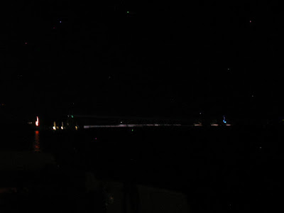
Tacking back and forth, fighting my way upwind and up river was tough. I sailed about 7 miles, but given all of the tacking, I was only 1.5 miles closer to my destination. The only place where I KNEW I could anchor comfortably was still 4 miles away and sunset was in 30 minutes. It was going to take another 3 hours by sail. Even under motor, it was still at least 45 minutes. Dropped sails and started the motor. It was a wet ride pushing through the chop head on. It was getting darker and I was still a ways from Bay City. I saw what looked like a mast near the shore about 2 miles up the river. Got the binoculars and sure enough there was a 25-30 foot boat at anchor, and there seemed to be relatively protected thanks to an outcrop of the shoreline. I headed for it. As I got closer I realized it wasn't anchored, it was on a mooring. Motored about 300 yards past to tuck up closer to that outcrop. Dropped anchor around 8:30, and all of a sudden, like someone flipped a switch, the wind died. I was still a few miles south (east) of Bay City, where I had planned to anchor, but with a protective lee shore and nearly no wind, I was happy where I was. Pulled out a cigar, fired up George Jones on the Ipod, and watched the stars come out. I was only about 100 yards outside of the main channel, and I was starting to wonder if I was too close. I had my anchor light on, but still a little paranoid. The marked channel was pretty narrow at that point, and I was even thinking a barge might swing wide and come out of the channel, or a speed boat/cabin cruiser could easily end up on the wrong side of the channel marker at night. Then I saw a big spot light in the the distance, likely a barge. At least I would be awake and above deck if this didn't go well.
 |
| From Lake Pepin - Aug 09 |
He had the spot light pointed at the shoreline just up river from me. Huh, I wonder if he sees me.
 |
| From Lake Pepin - Aug 09 |
Yeah, he sees me. Here he is passing by, in the channel.
 |
| From Lake Pepin - Aug 09 |
Finished the cigar, had a peanut butter sandwich, and went to bed. I slept much better than expected. Temps were in the low 50s, perfect for the sleeping bag. I have a screen that replaces the companion way hatch, which kept the air moving. I wouldn't say it was the most comfortable place I have ever slept, but it was much better than I expected. Got up at 7am in dead calm water, plenty of fishing boats trolling all around me. I wanted to see the northern most part of the lake, so I pulled up anchor and started trolling up river. Wind started to pick up a little (3-4mph), so I put up the sails, but it was difficult fighting the current, and the channel was narrow. Bay City (northern most part of the lake) is up there somewhere.
 |
| From Lake Pepin - Aug 09 |
I decided it was too narrow to sail, and I had identified a few places that I could anchor along the shore when I come back to Lake Pepin, so making it all the way up to Bay City wasn't really necessary (and it would require the motor). Turned the boat around and started heading down river. Winds were 0-4 mph, current was 1.2-1.5 mph. I was mostly just drifting back down river. After about 5 miles I was getting antsy, my wife called to ask when I would be home, and a buddy called and asked if I could help him paint in the afternoon. So I pulled down the sails (they weren't doing much), and fired up the motor. Another 2 hours of motoring back to the ramp, trailered the boat, and headed home. It was my first night aboard, and it was a great time.
Northern Lake Pepin
The Good:
The river narrows north of Hansen's, but it's still about 1 mile wide. Another 4.5 miles north to Maiden Rock, and the river widens considerably, but the official channel actually narrows. The bluffs seem to channel the wind here, there were some rough waves in the high wind. Anchoring was no problem, the bottom was a heavy black clay, and setting the anchor was no problem. The views are great. Not many boats in the high winds, but there were speed/fishing/cruising boats blowing past me every 15 minutes or so Sunday morning when the wind was dead. In terms of sailing, the area south of Hansen's looks better, and there is a sand bar just north of Hansen's that would offer good protection for anchoring if the winds are coming from the West or North. That's probably where I'll sail/anchor next time.
The Bad:
There is a significant difference between the width of the river, and the width of the official channel. Not a big deal given the shoal keel, except I came across a couple of these things:
 |
| From Lake Pepin - Aug 09 |
Partially submerged logs. I think one end of the log is buried in the muck, the other is just above/below the surface (dead heads). In the strong winds I saw one that was only visible in the trough of the wave, scared me when I saw it and realized I was well outside of the marked channel. Keeping a close eye out for these may not be enough as one just a few inches below the surface may not be visible. If you leave the marked channel, you're taking a risk. There were also a few sand bars with only an inch of water above them, but they were easily identified by all of the birds standing on them. When I go back, I plan to stay south of Maiden Rock. The channel is very wide, and I saw a lot of sail boats 1-2 miles south of Hansen's.
No comments:
Post a Comment